The Khanouqa dam and the Semiramis canal
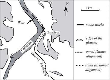
At the Khanouqa gap on the Euphrates some 80 km upstream of its confluence with the Khabur, are the remains of hydraulic works.[69] This includes a rock weir, built of loose natural basalt blocks, damming the Euphrates so as to provide all-season water to a canal whose offtake is immediately upstream of the dam (Figure 2.13). The left-bank canal is called the canal of Semiramis[70] in the writings of the Greek traveler Isidore of Charax, dating from the first century AD:
“There is found the canal of Semiramis; the Euphrates is blocked by rocks so that, in its narrowed state, it floods the plain; but in the summer boats run aground there.” [71]
 |
 |
Remnants of the canal are partially visible in the vicinity of Khabur, along about 80 km. Navigation is clearly the main purpose of the canal, but it could obviously have also been used for irrigation. It is not possible to assign a precise period to these remains. Yves Calvet and Bernard Geyer suggest that the most likely period is from the end of the IIIrd millennium BC until the beginning of the IInd millennium BC. This is a period of prosperity for Mari, but does not exclude the possibility that the works date from a later time, in the Ist millennium BC (but the construction does not appear to be of Assyrian workmanship, and therefore we are inclined to favor the earlier hypothesis.)
|
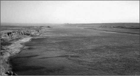
Figure 2.14 The Euphrates at the Khanouqa gap. The path of the canal of Semiramis passes at the foot of the cliff in the background, on top of which one can distinguish the ruins of the Hellenistic city of Zalabiyya. The photo is taken at the location indicated by a V on Figure 2.13 (photo by the author). |


Leave a reply